Satellite Image Supplier
Advertisement
Global Satellite Map v.8.0.0.6028
Global satellite map is a very high resolution global satellite image mosaic of the earth,These images have been collected during 2000-2004, and one of the bands has a ground relative resolution of 15 meters, or 50 foot.
Advertisement
Largest Satellite Images v.1
Can you imagine how large an satellite image is, which has dimensions of 86400 pixels wide and 43200 pixels high?This is a simple article which describes the Worlds Largest Satellite Images.
Encom PA v.10.0.18
With Encom PA, you can see and compare all your line data, profiles, grids, modelling, images, drilllholes, maps and 3D visualisations in a single interactive interpretation environment.
RealMeteo v.4.15.5
It is a friendly realtime interface that shows weather images. Realmeteo has a wide database of weather satellite images link. Is a friendly realtime interface that shows weather images. Realmeteo has a wide database of weather satellite image links.
Webmizzle
Webmizzle is a simple tool for monitoring current weather condition. I wrote this program because I felt sick when I had to launch Internet Explorer and then browse through the ads and other crap just to see a satellite image or current temperature. And
Magic Map (North America Edition) v.1.1.0
Magic Map helps you locate your targets quickly by phone numbers, street addresses, or zip numbers. You can try to find anything you like around any neighborhood using the new local search feature.
Orbit Visualization Tool v.2 3
The Orbit Visualization Tool (OVT) is a software for visualization of satellite orbits in the Earth's magnetic field.
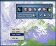
Weather1 Lite v.1.0
Weather1-Lite allows you to track weather conditions for your zip code, including 5-day forecast and access to popular satellite and radar imagery.
GeoVisu v.5.0.1
GeoVisu is a program that displays georeferenced data (images, graphics) and downloads data recorded by some GPS devices. GeoVisu has a 'Moving map' navigation function, which can be used with any NMEA 0183 compatible or Garmin USB GPS device.
PANCROMA v.4 8
PANCROMA pan sharpening is the Simple yet Powerful GIS software application for creating 15m resolution color pan sharpened images from FREE Landsat ETM satellite data for ANY part of the world.

Tweather v.1.0.0.0
Developed by : Mark Anthony Morada Tweather is a Windows Phone Application that parses weather updates from the Philippine Atmospheric Geophysical Astronomical Services Administration (PAGASA) news sources online. It fetches the latest satellite